This is an update to the iPhones for Owls post from earlier this week. The Owl Research Institute is looking for donated iPhones for their work. One of you asked for more info on what they’d be used for, so I emailed them to ask. Here’s what I found out:
Hi xxxxxxxxxx, Thank you for sharing our social media post! We are currently setting up ArcGIS software and our new part time employee Troy Gruetzmacher (who has also started an ARU company called owlsense.co) is helping us with writing some software to analyze the data we collect. Finger’s crossed we get some great iPhone donations! Thank you again for spreading the word and for your interest in Owls and the ORI. Warm regards, Jeanna Clifford Communications Director ORI
ArcGIS looks to be interactive mapping software. From Wikipedia:
ArcGIS is built around a geodatabase, which uses an object–relational database approach for storing spatial data. A geodatabase is a “container” for holding datasets, tying together the spatial features with attributes. The geodatabase can also contain topology information, and can model behavior of features, such as road intersections, with rules on how features relate to one another.[68] When working with geodatabases, it is important to understand feature classes which are a set of features, represented with points, lines, or polygons. With shapefiles, each file can only handle one type of feature. A geodatabase can store multiple feature classes or type of features within one file.
They have some free maps with public access, such as this Active US Forest Fires map you can explore to get an idea of how it works to visualize data. Here’s another one of US Air Quality data.
It’s not difficult to imagine many possible uses tracking owls, nesting sites, etc.
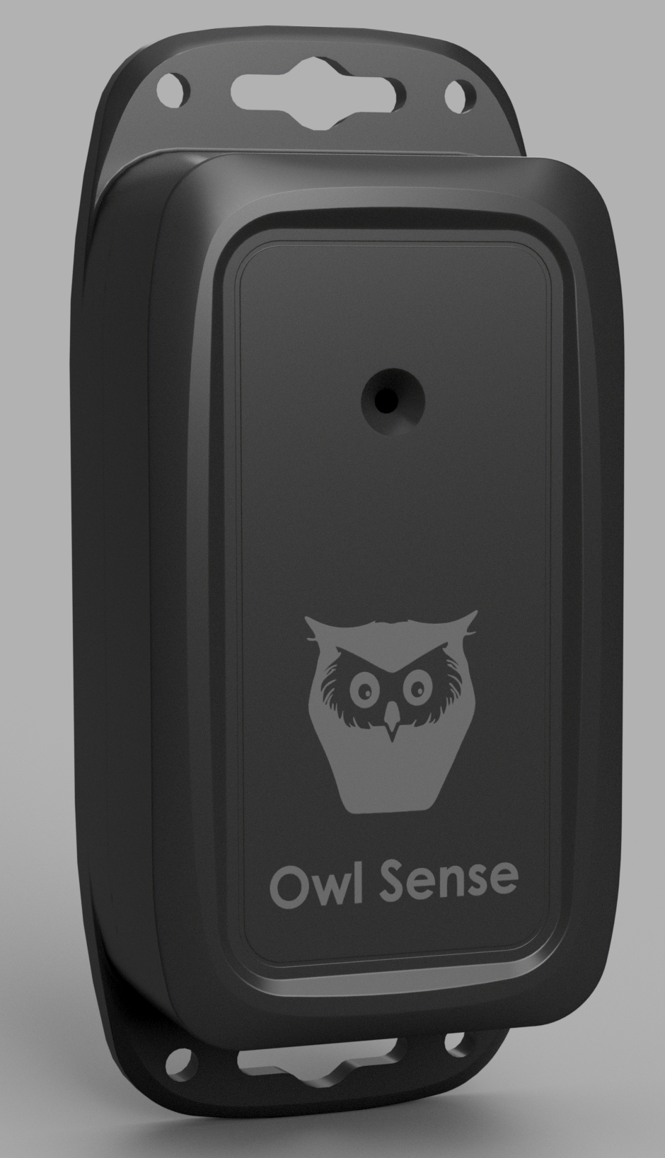
Owl Sense makes cheap but effective ARUs, autonomous recording units. It’s link a trail camera, but for sound instead of photos. From Wikipedia:
An autonomous recording unit (ARU) is a self-contained audio recording device that is deployed in marine or terrestrial environments for bioacoustical monitoring. The unit is used in both marine and terrestrial environments to track the behavior of animals and monitor their ecosystems. On a terrestrial level, the ARU can detect noises coming from bird habitats and determine relative emotions that each bird conveys along with the population of the birds and the relative vulnerability of the ecosystem.
The wiki link also mentions that the software for don’t can shift the sounds of cetaceans to frequencies humans can actually hear, which seems helpful.
I did find one of Burrow Owl habitats in part of California, but it doesn’t show much so I grabbed it for a screenshot.

The Owl Sense device uses an iOS app to do its configuration. Here’s the app link if you’d like to see it, but it just looks like a big settings screen.
Here’s the guy working on it. He says he developed it originally to track Great Grays.

I hope that was helpful. Big thanks again to those of you that said you had some to send them. If you know anyone that has some, spread the word!
Here’s the info again for anyone but wanting to go to the Facebook link.

Those are some great insights I would’ve never thought of. Thanks for that!
ARUs seem like very neat devices for birding. I’ve been curious to learn more about BirdNET-PI builds to autonomously see who all has been coming to my yard that I don’t get to see.